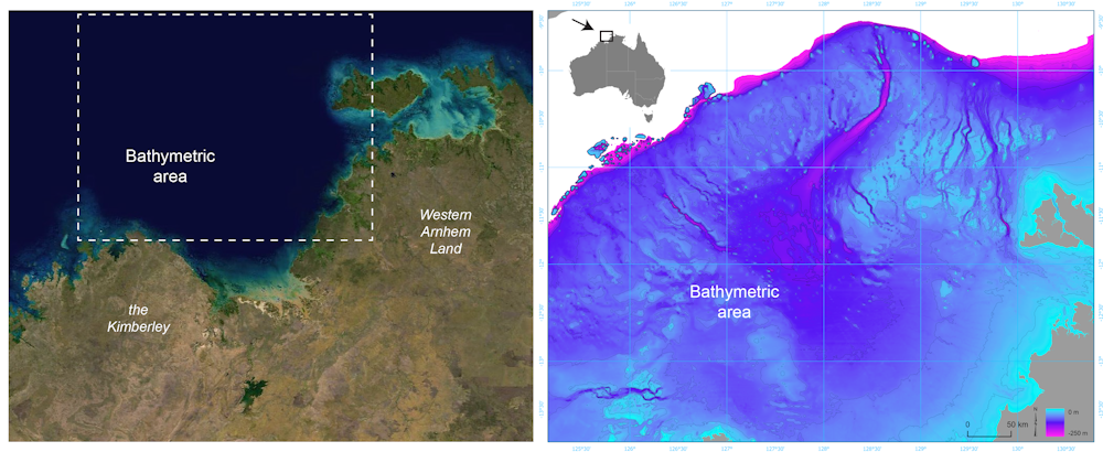
For much of the 65,000 years of Australia’s human history, the now-submerged northwest continental shelf connected the Kimberley and western Arnhem Land. This vast, habitable realm covered nearly 390,000 square kilometres, an area one-and-a-half times larger than New Zealand is today.
Left: Satellite image of the submerged northwest shelf region. Right: Drowned landscape map of the study area. US Geological Survey, Geoscience Australia
It was likely a single cultural zone, with similarities in ground stone-axe technology, styles of rock art, and languages found by archaeologists in the Kimberley and Arnhem Land.
There is plenty of archaeological evidence humans once lived on continental shelves – areas that are now submerged – all around the world. Such hard evidence has been retrieved from underwater sites in the North Sea, Baltic Sea and Mediterranean Sea, and along the coasts of North and South America, South Africa and Australia.
In a newly published study in Quaternary Science Reviews, we reveal details of the complex landscape that existed on the Northwest Shelf of Australia. It was unlike any landscape found on our continent today.
A continental split
Around 18,000 years ago, the last ice age ended. Subsequent warming caused sea levels to rise and drown huge areas of the world’s continents. This process split the supercontinent of Sahul into New Guinea and Australia, and cut Tasmania off from the mainland.
Unlike in the rest of the world, the now-drowned continental shelves of Australia were thought to be environmentally unproductive and little used by First Nations peoples.
But mounting archaeological evidence shows this assumption is incorrect. Many large islands off Australia’s coast – islands that once formed part of the continental shelves – show signs of occupation before sea levels rose.
Stone tools have also recently been found on the sea floor off the coast of the Pilbara region of Western Australia.
Not exactly a conservation topic, I know, but it does provide insights into how the ancestors of Indigenous Australians adapted to and thrived in a new and sometimes harsh landscape. The more I study elements of human ecology in deep time, the more awed I become at the frankly amazing capacity of First Peoples.
We combined new models of demography and wayfinding based on geographic inference to show the scale of the challenges faced by the ancestors of Indigenous people making their mass migration across the supercontinent more than 60,000 years ago.
The ancestors of Aboriginal people likely first entered the continent 75,000–50,000 years ago from what is today the island of Timor, followed by later migrations through the western regions of New Guinea.
This pattern led to a rapid expansion both southward toward the Great Australian Bight, and northward from the Kimberley region to settle all parts of New Guinea and, later, the southwest and southeast of Australia.
We did this research under the auspices of the ARCCentre of Excellence for Australian Biodiversity and Heritage (CABAH) and including international experts in Australia and the United States to investigate the most likely pathways and the timeframe needed to reach population sizes able to withstand the rigours of their new environment.
By combining two existing models predicting the routes these First Peoples took – ‘superhighways’ – and the demographic structure of these first populations, we were able to estimate the time for continental saturation more precisely. The new research has just been published in the journal Quaternary Science Reviews.
Based on detailed reconstructions of the topography of the ancient continent and models of past climate, we developed a virtual continent and programmed populations to survive in and move successfully through their new territory.
Navigating by following landscape features like mountains and hills and knowing where to find water led to successful navigation strategies. The First Peoples of Australia soon passed along cultural knowledge to subsequent generations facilitating the peopling of the whole continent.
I’m very chuffed today to signal the publication of what I think is one of the most important contributions to the persistent conundrum surrounding the downfall of Australia’s megafauna many tens of millennia ago.
Sure, I’m obviously biased in that assessment because it’s a paper from our lab and I’m a co-author, but if readers had any inkling of the work that went into this paper, I think they might consider adopting my position. In addition, the injection of some actual ecology into the polemic should be viewed as fresh and exciting.
Having waded into the murky waters of the ‘megafauna debate’ for about a decade now, I’ve become a little sensitive to even a whiff of binary polemic surrounding their disappearance in Australia. Acolytes of the climate-change prophet still beat their drums, screaming for the smoking gun of a spear sticking out of a Diprotodon‘s skull before they even entertain the notion that people might have had something to do with it — but we’ll probably never find one given the antiquity of the event (> 40,000 years ago). On the other side are the blitzkriegers who declaim that human hunting single-handedly wiped out the lot.
Well, as it is for nearly all extinctions, it’s actually much more complicated than that. In the case of Sahul’s megafauna disappearances, both drivers likely contributed, but the degree to which both components played a part depends on where and when you look — Fred Saltrédemonstrated that elegantly a few years ago.
So, why does the polemic persist? In my view, it’s because we have largely depended on the crude comparison of relative dates to draw our conclusions. That is, we look to see if some climate-change proxy shifted in any notable way either before or after an inferred extinction date. If a particular study claims evidence that a shift happened before, then it concludes climate change was the sole driver. If a study presents evidence that a shift happened after, then humans did it. Biases in geochronological inference (e.g., spatial, contamination), incorrect application of climate proxies, poor taxonomic resolution, and not accounting for the Signor-Lipps effect all contribute unnecessarily to the debate because small errors or biases can flip relative chronologies on their head and push conclusions toward uncritical binary outcomes. The ‘debate’ has been almost entirely grounded on this simplistically silly notion.
This all means that the actual ecology has been either ignored or merely made up based on whichever pet notion of the day is being proffered. Sure, there are a few good ecological inferences out there from some damn good modellers and ecologists, but these have all been greatly simplified themselves. This is where our new paper finally takes the ecology part of the problem to the next level.
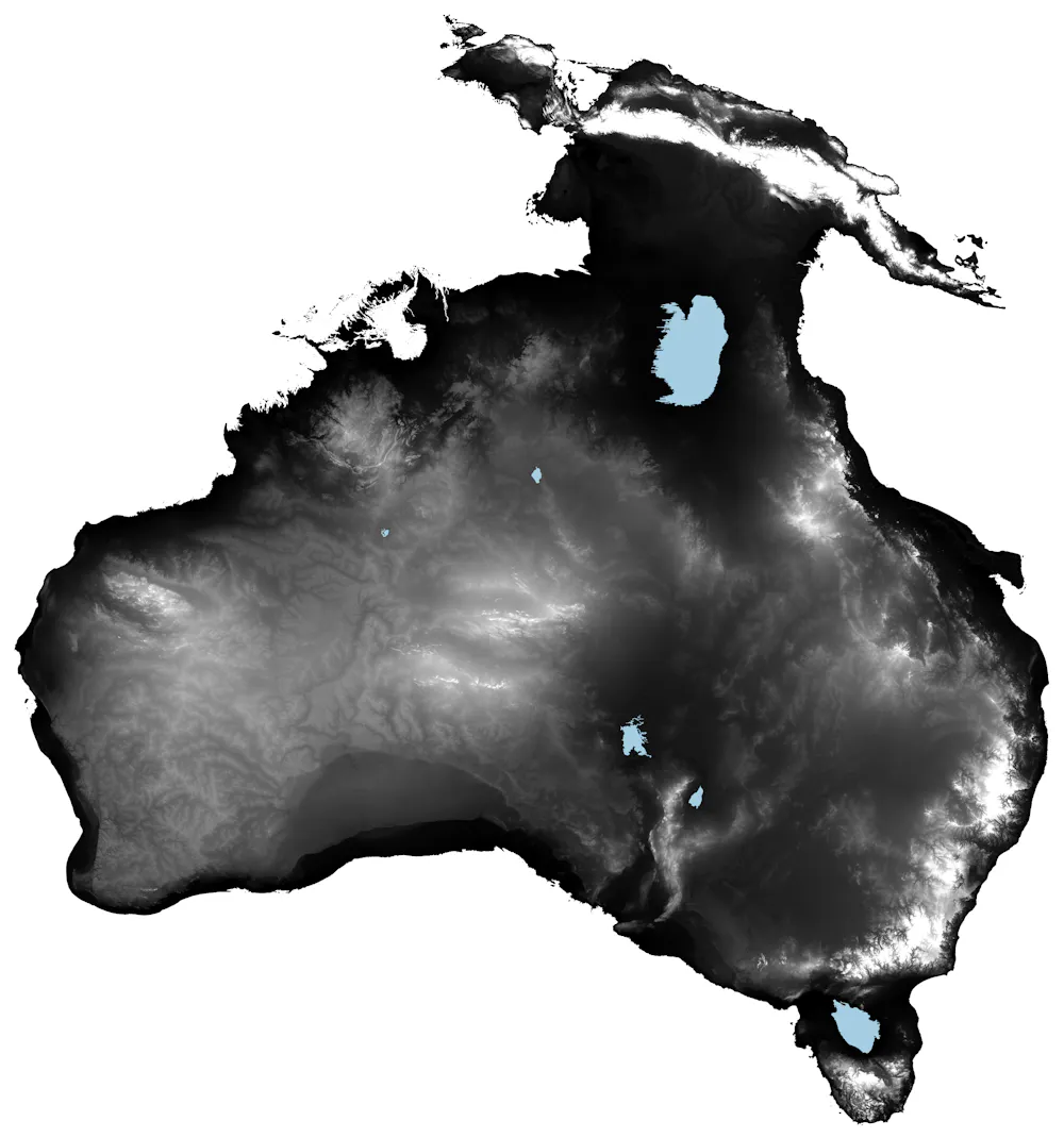
We know it is more than 60,000 years since the first people entered the continent of Sahul — the giant landmass that connected New Guinea, Australia and Tasmania when sea levels were lower than today.
But where the earliest people moved across the landscape, how fast they moved, and how many were involved, have been shrouded in mystery.
Our latest research, published today shows the establishment of populations in every part of this giant continent could have occurred in as little as 5,000 years. And the entire population of Sahul could have been as high as 6.4 million people.
This translates to more than 3 million people in the area that is now modern-day Australia, far more than any previous estimate.
The first people could have entered through what is now western New Guinea or from the now-submerged Sahul Shelf off the modern-day Kimberley (or both).
But whichever the route, entire communities of people arrived, adapted to and established deep cultural connections with Country over 11 million square kilometres of land, from northwestern Sahul to Tasmania.
Map of what Australia looked like for most of the human history of the continent when sea levels were lower than today. Author provided
This equals a rate of population establishment of about 1km per year (based on a maximum straight-line distance of about 5,000km from the introduction point to the farthest point).
That’s doubly impressive when you consider the harshness of the Australian landscape in which people both survived and thrived.
For many years I’ve been interested in modelling the extinction dynamics of megafauna. Apart from co-authoring a few demographically simplified (or largely demographically free) models about how megafauna species could have gone extinct, I have never really tried to capture the full nuances of long-extinct species within a fully structured demographic framework.
That is, until now.
But how do you get the life-history data of an extinct animal that was never directly measured. Surely, things like survival, reproductive output, longevity and even environmental carrying capacity are impossible to discern, and aren’t these necessary for a stage-structured demographic model?
The answer to the first part of that question “it’s possible”, and to the second, it’s “yes”. The most important bit of information we palaeo modellers need to construct something that’s ecologically plausible for an extinct species is an estimate of body mass. Thankfully, palaeontologists are very good at estimating the mass of the things they dig up (with the associated caveats, of course). From such estimates, we can reconstruct everything from equilibrium densities, maximum rate of population growth, age at first breeding, and longevity.
But it’s more complicated than that, of course. In Australia anyway, we’re largely dealing with marsupials (and some monotremes), and they have a rather different life-history mode than most placentals. We therefore have to ‘correct’ the life-history estimates derived from living placental species. Thankfully, evolutionary biologists and ecologists have ways to do that too.
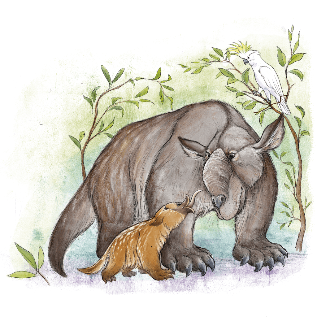
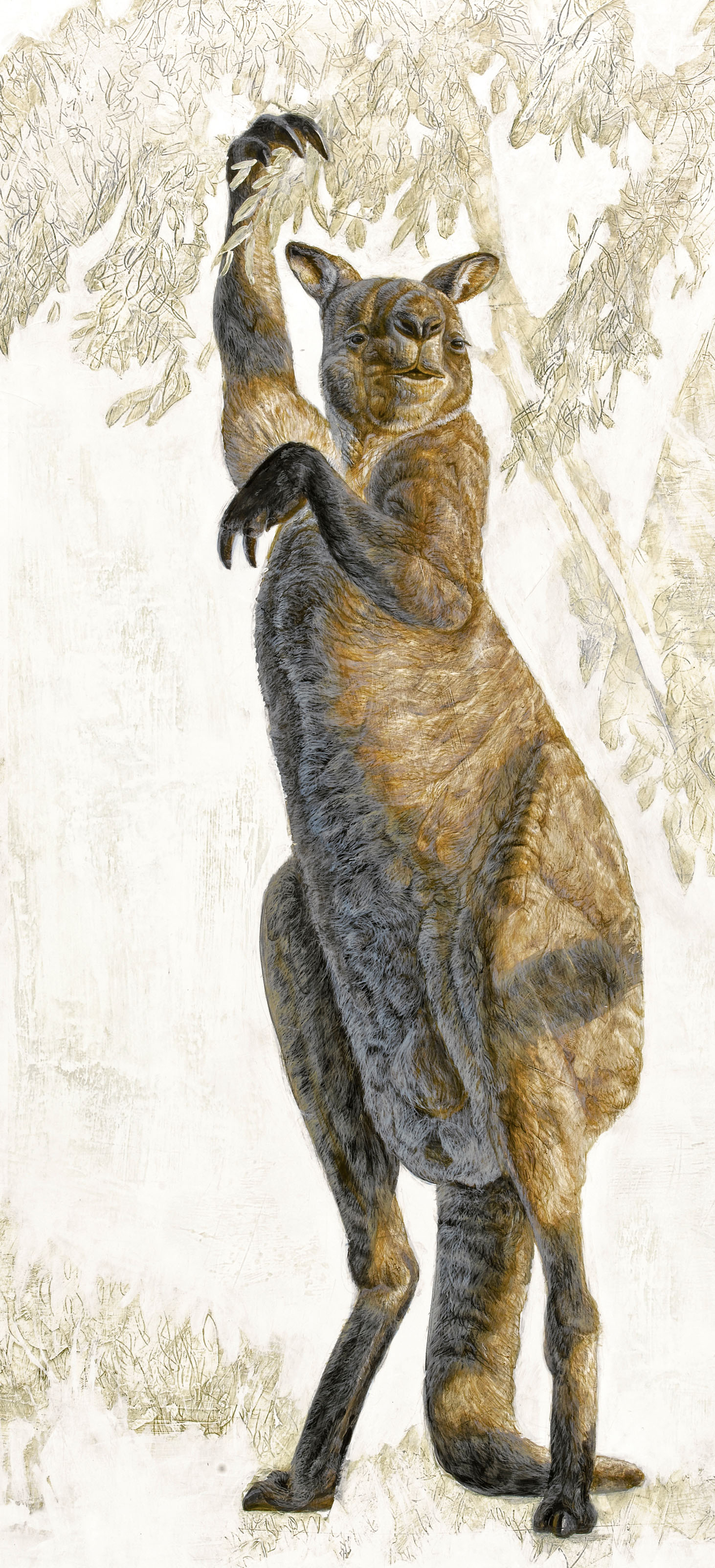
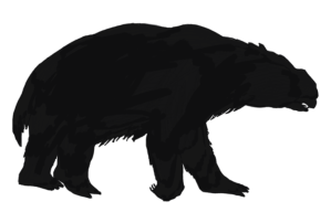
The Pleistocene kangaroo Procoptodon goliah, the largest and most heavily built of the short-faced kangaroos, was the largest and most heavily built kangaroo known. It had an unusually short, flat face and forwardly directed eyes, with a single large toe on each foot (reduced from the more normal count of four). Each forelimb had two long, clawed fingers that would have been used to bring leafy branches within reach.
So with a battery of ecological, demographic, and evolutionary tools, we can now create reasonable stochastic-demographic models for long-gone species, like wombat-like creatures as big as cars, birds more than two metres tall, and lizards more than seven metres long that once roamed the Australian continent.
Ancient clues, in the shape of fossils and archaeological evidence of varying quality scattered across Australia, have formed the basis of several hypotheses about the fate of megafauna that vanished during a peak about 42,000 years ago from the ancient continent of Sahul, comprising mainland Australia, Tasmania, New Guinea and neighbouring islands.
There is a growing consensus that multiple factors were at play, including climate change, the impact of people on the environment, and access to freshwater sources.
Just published in the open-access journal eLife, our latest CABAH paper applies these approaches to assess how susceptible different species were to extinction – and what it means for the survival of species today.
Using various characteristics such as body size, weight, lifespan, survival rate, and fertility, we (Chris Johnson, John Llewelyn, Vera Weisbecker, Giovanni Strona, Frédérik Saltré & me) created population simulation models to predict the likelihood of these species surviving under different types of environmental disturbance.
We compared the results to what we know about the timing of extinction for different megafauna species derived from dated fossil records. We expected to confirm that the most extinction-prone species were the first species to go extinct – but that wasn’t necessarily the case.
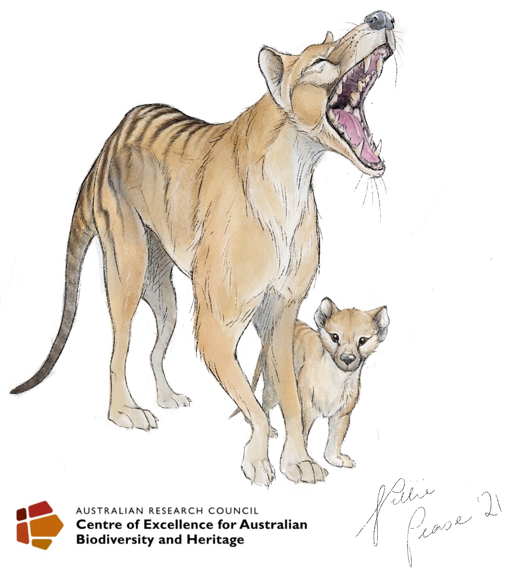
While we did find that slower-growing species with lower fertility, like the rhino-sized wombat relative Diprotodon, were generally more susceptible to extinction than more-fecund species like the marsupial ‘tiger’ thylacine, the relative susceptibility rank across species did not match the timing of their extinctions recorded in the fossil record.
Indeed, we found no clear relationship between a species’ inherent vulnerability to extinction — such as being slower and heavier and/or slower to reproduce — and the timing of its extinction in the fossil record.
In fact, we found that most of the living species used for comparison — such as short-beaked echidnas, emus, brush turkeys, and common wombats — were more susceptible on average than their now-extinct counterparts.
Earth is now firmly in the grips of its sixth “mass extinction event”, and it’s mainly our fault. But the modern era is definitely not the first time humans have been implicated in the extinction of a wide range of species.
In fact, starting about 60,000 years ago, many of the world’s largest animals disappeared forever. These “megafauna” were first lost in Sahul, the supercontinent formed by Australia and New Guinea during periods of low sea level.
The main way to investigate this question is to build timelines of major events: when species went extinct, when people arrived, and when the climate changed. This approach relies on using dated fossils from extinct species to estimate when they went extinct, and archaeological evidence to determine when people arrived.
Comparing these timelines allows us to deduce the likely windows of coexistence between megafauna and people.
We can also compare this window of coexistence to long-term models of climate variation, to see whether the extinctions coincided with or shortly followed abrupt climate shifts.
Data drought
One problem with this approach is the scarcity of reliable data due to the extreme rarity of a dead animal being fossilised, and the low probability of archaeological evidence being preserved in Australia’s harsh conditions. Read the rest of this entry »
Over the last 60,000 years, many of the world’s largest species disappeared forever. Some of the largest that we generally call ‘megafauna’ were first lost in Sahul — the super-continent formed by the connection of Australia and New Guinea during periods of low sea level. The causes of these extinctions have been heavily debated for decades within the scientific community.
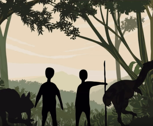
Three potential drivers of these extinctions have been suggested. The first is climate change that assumes an increase in arid conditions that eventually became lethal to megafauna. The second proposed mechanism is that the early ancestors of Aboriginal people who either hunted megafauna species to extinction, or modified ecosystems to put the largest species at a disadvantage. The third and most nuanced proposed driver of extinction is the combination of the first two.
The primary scientific tools we scientists use to determine which of these proposed causes of extinction have the most support are dated fossil records from the extinct species themselves, as well as archaeological evidence from early Aboriginal people. Traditionally, the main way we use these data is to construct a timeline of when the last fossil of a species was preserved, and compare this to evidence indicating when people arrived. We can also reconstruct climate patterns back tens of thousands of years using models similar to the ones used today to predict future climates. Based on the comparison of all of these different timelines, we conclude that abrupt climate changes in the past were influential if they occurred at or immediately before a recorded extinction event. On the other hand, if megafauna extinctions occur immediately after humans are thought to have arrived, we attribute more weight to human arrival as a driver.
Australia is home to some of the most unique species worldwide, including egg-laying mammals, tree-climbing, desert-bouncing and and burrow-digging marsupials, and huge flightless birds. While these animals are fascinating, the creatures that used to roam Australia’s landscape thousands of years ago were even more remarkable — these included wombat-like beasts as big as rhinos, birds more than two metres tall, lizards more than seven metres long, and a marsupial lion as big as a leopard.
Just how and why these animals went extinct has been challenging scientists for decades. But examining dated fossil records is one of the primary ways we can look into the past. The ever-increasing number of fossils and the advances in dating techniques have produced a wealth of material we can use to reconstruct the long-lost past.
Even with these data, it has been a struggle to gather enough fossils for large-scale analyses because reports of these records are usually scattered across the scientific literature, with no standardised quality control to make them comparable to each other. Designing a way to standardise these records is therefore important to avoid misleading conclusions.
The FosSahul database was first established in 2016 to try to alleviate these problems — it gathered all the fossil specimens for large animals (excluding humans) from the Late Quaternary (up to ~ 1 million years before present) across the region known as ‘Sahul’, the combined super-continent that included New Guinea and Australia when sea levels were much lower than they are today.
While FosSahul was an important step, the database needed to be updated. First, the quality rating of the fossil dates in the original version was a little subjective and lacked transparency in some cases. This is because the database did not capture enough detail to be able to reproduce all the steps leading to a particular quality rating. Second, given that new fossils are discovered regularly, updates are necessary to include the latest research. Read the rest of this entry »
A few weeks ago I wrote a post about how to run the perfect scientific workshop, which most of you thought was a good set of tips (bizarrely, one person was quite upset with the message; I saved him the embarrassment of looking stupid online and refrained from publishing his comment).
As I mentioned at the end of post, the stimulus for the topic was a particularly wonderful workshop 12 of us attended at beautiful Linnaeus Estate on the northern coast of New South Wales (see Point 5 in the ‘workshop tips’ post).
I hate to say it – mainly because it deserves as little attention as possible – but the main reason is that we needed to clean up a bit of rubbish. The rubbish in question being the latest bit of excrescence growing on that accumulating heap produced by a certain team of palaeontologists promulgating their ‘it’s all about the climate or nothing’ broken record.
Those of us living with cats share our homes with an ancestral predator, one adapted for hunting and the frequent, exclusive consumption of meat. These instincts become fully activated outside the domestic environment, where cats pose a global threat to wildlife. Pets are family. We celebrate their arrival with the same joy as a grand…
Many animals avoid contact with people. In protected areas of the African savanna, mammals flee more intensely upon hearing human conversations than when they hear lions or sounds associated with hunting. This fear of humans affects how species use and move in their habitat. Throughout our lives, we interact with hundreds of wildlife species without…
Deep-sea sharks include some of the longest-lived vertebrates known. The record holder is the Greenland shark, with a recently estimated maximum age of nearly 400 years. Their slow life cycle makes them vulnerable to fisheries. Humans rarely live longer than 100 years. But many other animals and plants can live for several centuries or even millennia, particularly…


 Over the last 60,000 years, many of the world’s largest species disappeared forever. Some of the largest that we generally call ‘megafauna’ were first lost in Sahul — the super-continent formed by the connection of Australia and New Guinea during periods of low sea level. The causes of these extinctions have been heavily debated for decades within the scientific community.
 Even with these data, it has been a struggle to gather enough fossils for large-scale analyses because reports of these records are usually scattered across the scientific literature, with no standardised quality control to make them comparable to each other. Designing a way to standardise these records is therefore important to avoid misleading conclusions.


